We have created this Dubai Metro map from the information that we have gathered about the Dubai Metro stations, the zones and the current information about stations that are open.
Please note that this Dubai Metro Map is subject to copyright and should not be used without our express permission.
We will continue to keep the Dubai Metro map updated with station name changes and any additional stations that may open once the metro gets extended further out.
Station name changes happen occasionally due to companies purchasing the branding rights for a particular station, you can read about any changes in the news section.
You can click on the map for a larger version and print it if required.
2024 Dubai Metro Map (click to enlarge)
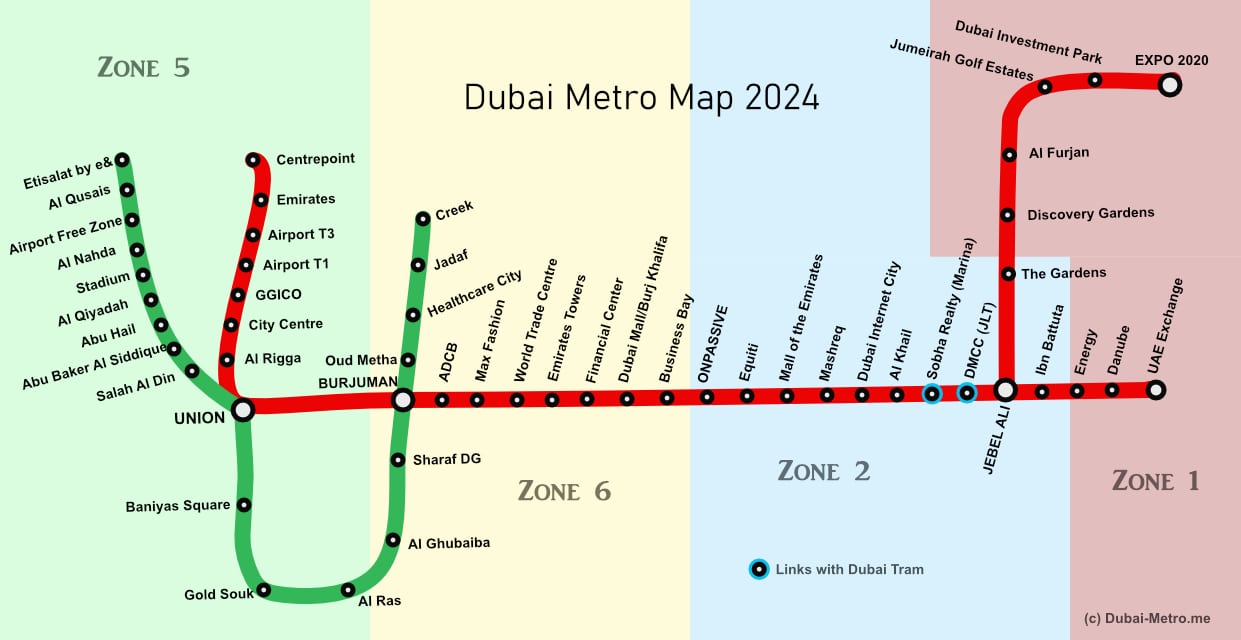

After the red line opening on 9 September 2009, the green line of the Dubai Metro opened on 9 September 2011. A few of the stations did not open straight away. However, as of 1 March 2014 all of the stations were fully open on both the green and red lines and in 2021 the Expo 2020 extension was also fully opened.
Both the green and the red lines will likely be extended further in the future to add to the 18 green line stations and the 35 red line station currently being used. There may also be other lines opening in the future. Check out the news page for ongoing information.
As you can see from the Dubai Metro Zones Map, there are currently 4 zones that encompass the Dubai Metro. There are 7 zones in total that also cover other methods of public transport, like the buses and the tram.
The number of zones that you travel through determines the price of the journey. You can buy tickets that encompass all zones, e.g. a one day pass.
Check out the Dubai Metro Tickets page for full information about the fares payable. Fares increased in November 2014 when the Tram opened but still offer great value for money.